✨ The Standard for Security Design
Design smarter systems.
Visualize instantly.
The all-in-one platform for CCTV planning. From satellite mapping to professional BOQ reports in minutes, not hours.
Everything you need
Powerful features built for modern security workflows.
🌍
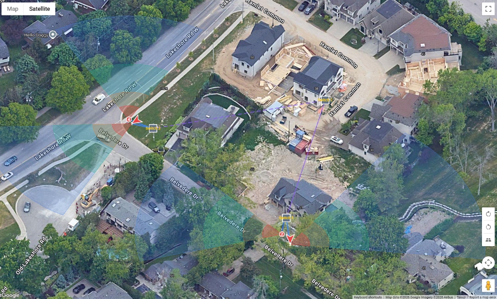
Global Mapping
Satellite precision anywhere in the world. Overlay blueprints or rely on Google imagery.
📐
Smart Calculations
Automatic DORI analysis, blind spot detection, and pixel density calculators.
📑
Instant BOQ
Generate professional PDF reports with equipment lists, cable runs, and storage needs.
🔐
Secure Sharing
Share read-only interactive maps with clients via a simple QR code or link.
☁️
Cloud Native
Access your designs from any device, anywhere. No installation required.
🎨
Custom Branding
White-label your exports with your company logo and details.